
Service · Engineering and construction
Photogrammetry and 3D models
Planned aerial capture to produce orthomosaics, point clouds and 3D models of sites and assets.
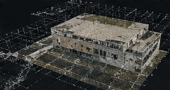
What you can get
- Planned aerial capture
- Orthomosaics
- Point clouds
- 3D models
- Documentation of land and assets
- Volume calculations, where the project allows
Who it is for
- Engineering firms
- Contractors
- Architects
- Land managers
- Civil works and quarries
Frequently asked questions
What information do you need to prepare a quote?
The location, the type of facility or asset, its approximate size, what you want to find out or solve and, if you have them, drawings, photos or previous reports. With this we assess feasibility and scope.
What affects whether drones can be used at a location?
Airspace rules, proximity to airports or restricted zones, people on site, the urban setting, the permits required and site conditions. We review these before every operation.
Related services
Solar PV inspection and cleaning
Thermal imaging of modules, anomaly location and planned specialist cleaning.
Specialist facade cleaning
Assessment of surfaces and access, and cleaning with a method suited to each facade.
Industrial and infrastructure inspection
Visual and thermal capture of roofs, structures, chimneys and infrastructure.
Which site or asset do you need documented?
Tell us the area, the objective and the formats you need.